About calands.org

CPAD and CCED are produced and managed by GreenInfo Network. Questions and comments about CPAD and CCED should be directed to cpad@calands.org.
Acknowledgment of Indigenous and Native Lands
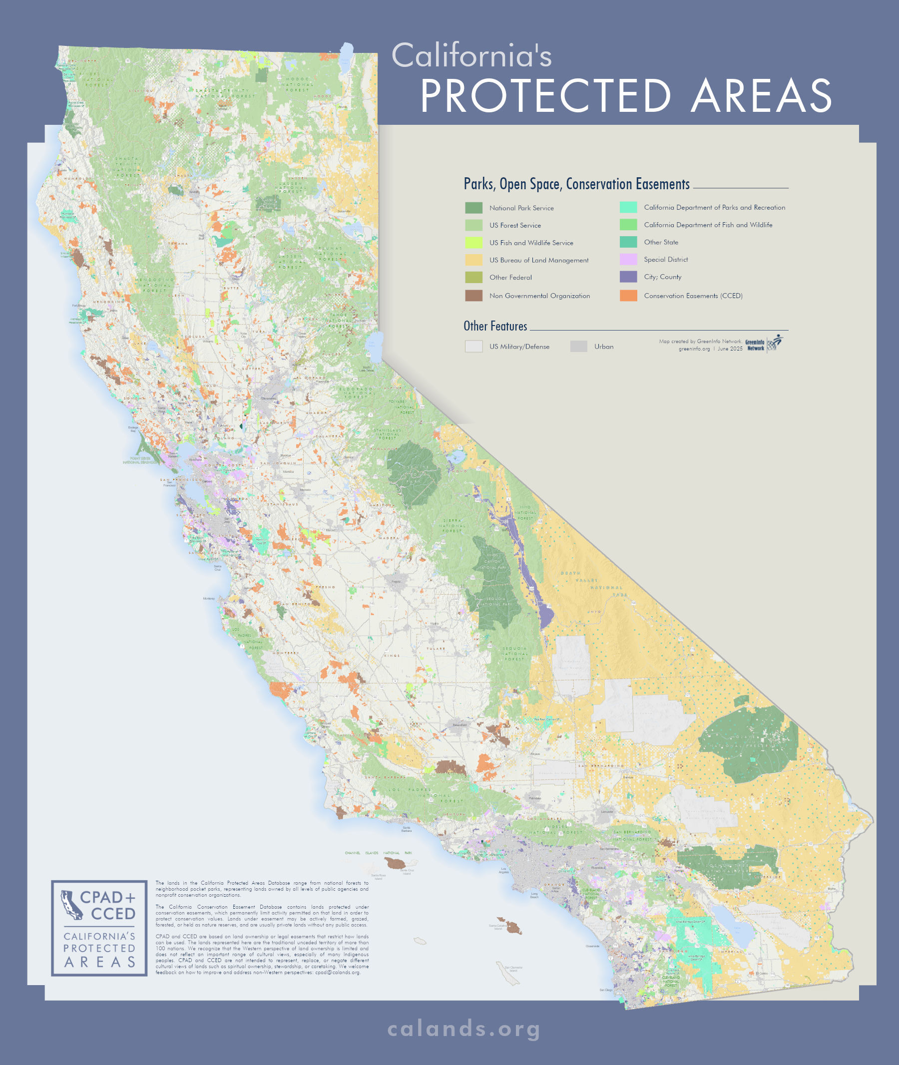
The GIS data in CPAD and CCED are based on land ownership or legal easements that restrict how lands can be used. The ownership focus of the databases is intended to assist in the planning, management, and long-term care of lands owned by government agencies and nonprofits for open space purposes. The lands represented here are the traditional unceded territory of more than 100 nations. To learn more about a particular territory please visit the California Native Heritage Commission’s Digital Atlas (opens in a new window) .
We recognize that the Western perspective of land ownership is limited and does not reflect an important range of cultural views, especially of many Indigenous peoples. Furthermore, land ownership as a structure has been used to promote empire and colonization.
These data represent only one lens of how to view California’s landscape. CPAD and CCED are not intended to represent, replace, or negate different cultural views of lands such as spiritual ownership, stewardship, or caretaking.
As we seek to respect the many diverse Indigenous people connected to this land from time immemorial, we welcome feedback on how to improve and address non-Western perspectives and how to respectfully represent them. Email us at cpad@calands.org.
Acknowledgments
Work on CPAD and CCED is currently funded by the California Natural Resources Agency and the California Department of Water Resources. Thanks to this generous support, GreenInfo Network can keep these important datasets up to date, responsive to user needs, and representative of best practices for open data.
The CPAD and CCED datasets are the result of work by many groups and individuals. GreenInfo Network greatly appreciates the contributions of time and data from hundreds of agencies and nonprofits, as well as the funding support of sponsors (see below), and the support of Esri for donations of ArcGIS software used to maintain CPAD and CCED data.
GreenInfo also acknowledges those originally involved in developing databases that eventually merged into the first CPAD in 2007. These pioneers have been essential to the success of CPAD and include Larry Orman, who built the first non-spatial database of the region’s public lands while at Greenbelt Alliance and then at GreenInfo Network; John Woodbury, original coordinator of the Bay Area Open Space Council (now known as TOGETHER Bay Area); and Darla Guenzler of the California Council of Land Trusts. In addition, GreenInfo’s longstanding partnership with TOGETHER Bay Area has been essential to the development of these datasets.
GreenInfo Network has worked over many years in partnership with the USGS Gap Analysis Program (GAP), which has supported developmental work on CPAD as it relates to the Protected Areas Database of the United States, and we appreciate their engagement and support.
During 2012-14, support for CPAD and CCED came through the California Strategic Growth Council, in collaboration with the USGS GAP. This project greatly improved CPAD data, including expansion of available easement data, refinements to the CPAD data model to better meet user needs, more outreach and coordination with agencies and organizations with CPAD holdings and recommendations for long term support of CPAD.
Sponsors
- California Natural Resources Agency
- California Department of Water Resources
- Los Angeles County
- Placeworks
- U.S. Geological Survey Gap Analysis Program
- California Strategic Growth Council
- California Department of Parks and Recreation
- Resources Legacy Fund Foundation
- California Council of Land Trusts
- The Annenberg Foundation
- The Bay Area Open Space Council
- The Sierra Nevada Conservancy
- California State Coastal Conservancy
- The Southern California Open Space Council
- The Central Coast Open Space Council
- Great Valley Center
- UC Davis Information Center for the Environment/Great Places Program
- The California Endowment
- California Department of Forestry and Fire Protection
- Pacific Gas and Electric Company
- Southern California Association of Governments

